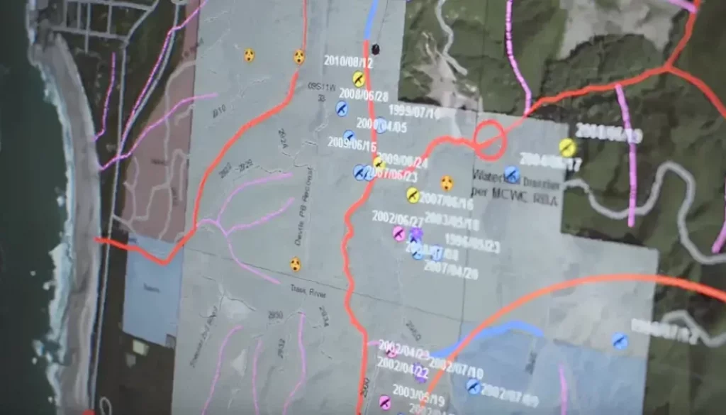
Geographic Information Systems
Geographic Information Systems (GIS) are a set of computer tools dedicated to capturing, storing, managing, analyzing, manipulating and presenting real geographic data linked to positions on the Earth’s surface.
This technology integrates location data with all kinds of descriptive information, being very useful in various areas such as scientific research, resource management, development planning, emergency response and many other applications.
The key feature of GIS technology is that it is spatial, which means that a portion of the data is spatially referenced to locations on earth.
Layers of a geographic information system
GIS systems consist of five layers, each of which performs a different but related function. Next we move on to the five layers:
- Reality mapping: This layer involves the creation of spatial reference frames. It takes real physical objects and locations and represents them using a coordinate system, known as a Spatial Reference System (SRS) or Coordinate Reference System (CRS).
- Data management: This layer consists of managing GIS databases that contain representations of geographic phenomena, modeling their geometry (location and shape) and their properties or attributes. The collection and management of this data often constitutes the majority of a project’s time and financial resources, far more than other aspects such as analysis and mapping.
- Analysis: This layer involves the analysis of GIS data to identify patterns and relationships between different aspects of the sewerage system. GIS is used to correlate sewer system data, helping to identify patterns and relationships between different aspects of the sewer system.
- Visualization: This layer consists of visualizing GIS data on a map. GIS integration allows you to see what is happening below the surface by plotting observations and locations on a map.
- Output: This layer involves the output of GIS data in various formats such as maps, reports, and graphs. GIS is used to create thematic maps of sewer conditions, helping to identify defects and safety issues before an asset fails.
In addition to these five layers, a geographic information system is also used for real-time monitoring of sewerage systems, which involves providing real-time situational awareness of wastewater operations and asset management.
Are geographic information systems used for real-time monitoring of sewerage systems?
And the answer is yes. Geographic information systems are used to monitor sewage systems in real time. Provides real-time situational awareness of wastewater operations and asset management by offering GIS-centric field and office work management workflows to streamline inspection activities.
The integration of geographic information systems also provides real-time editing capabilities for sewer inspection data.
This helps manage inspection activities, improve processes, and ensure that the entire organization has access to inspection information.

By using GIS for real-time monitoring, sewer companies quickly identify defects and safety issues before an asset fails, helping to reduce O&M costs.
How does GIS support sewer inspection?
Geographic information systems support sewer inspection in several ways:
- Geographic Visualization: GIS is used to geographically visualize sewer assets and inspection data, helping to identify patterns and relationships between different aspects of the sewer system.
- Integration with other platforms: GIS has the ability to integrate with other platforms to provide enhanced GIS capabilities for sewer inspection.
- Thematic Mapping: GIS is used to create thematic maps of sewer conditions, which help identify defects and safety issues before an asset fails.
- Sewer System Data Correlation: GIS is used to correlate sewer system data, helping to identify patterns and relationships between different aspects of the sewer system.
- Real-time editing capabilities: Provides real-time editing capabilities for sewer inspection data, helping to manage inspection activities and ensuring that the entire organization has access to inspection information.
In general, GIS technology supports sewer inspection by providing a platform to share data, improve management of sewer systems, conduct sanitary reviews, enhance wastewater surveillance programs, and integrate data collected during pipeline inspections. sewer.
What is the difference between vector and raster data in GIS layers?
Vector and raster data are two different types of data used in GIS layers. But let’s see what each of them means and in which area their application is best.
As for vector data, they represent geographic data symbolized as points, lines, or polygons. It uses XY coordinates to define the shape of an object based on its discrete boundaries.
It is best suited for applications involving the engineering and social sciences.
As for raster data, it represents geographic data as an array of cells, each of which contains an attribute value. It is most commonly used to represent continuous features such as elevation, temperature, and precipitation.
It is more suitable for applications involving the natural sciences.
Vector or raster data in sewerage systems?
Both vector and raster data are used in GIS layers for sewer systems, but the choice between the two depends on the type of data being represented and the specific application of the GIS system.
Vector data is used to represent discrete features, such as culverts, pipes, and other sewer assets. GIS integration allows you to see what is happening below the surface by plotting observations and locations on a map. Vector data is also used for spatial analysis to identify patterns and relationships between different aspects of the sewer system.
Raster data is used to represent continuous features such as elevation, temperature, and precipitation. Raster data is also used to create thematic maps of sewer conditions, helping to identify defects and safety issues before an asset fails.
In general, both vector and raster data are used in GIS layers for sewer systems, and the choice between the two depends on the specific application of the GIS system. GIS integration helps sewer utilities perform routine inspections, understand sewer conditions, record field inspections, manage inspection activities, and ensure that the entire organization has access to inspection information.
How is GIS used to analyze sewer system condition and performance?
In general, geographic information systems are used to analyze sewer system conditions and performance by correlating sewer system data, creating thematic maps, analyzing survey data, and managing sewer assets.
By using GIS for analysis, companies identify areas of the sewer system that need attention, prioritize maintenance and repair activities, ensuring assets are properly maintained and operating optimally.
Our services SEWDEF is an automatic system for detecting defects in sewerage networks based on artificial intelligence and artificial vision. Analyzes sewer network videos for defects and displays sewer system condition and performance information.
To known more about the SEWDEF system:
Advantages of integrating a geographic information system
We are going to see a series of advantages and benefits when using a geographic information system in your system:
What are some challenges in using GIS for sewer system analysis and how are they addressed?
Here are some challenges in using geographic information systems for analysis of the entire sewerage environment and how they are addressed:
GIS analysis requires high-quality data, which is a great challenge in sewerage systems due to the complexity of the data and the difficulty of collecting accurate data in the field.
Sewer systems often have data stored in multiple systems, making it difficult to integrate data for GIS analysis.
The implementation of a GIS system is expensive, which proves to be a great challenge for smaller sewer service companies.
GIS analysis requires specialized expertise. It is a challenge for sewer service companies that do not have staff with GIS experience.
And GIS solutions for sewer system analysis
To the problems and challenges exposed in the previous section, we are now going to see the following solutions:
Sewer utility companies address data quality issues by investing in top-quality collection methods and ensuring that data is collected consistently and accurately in the field.
Sewer utilities address data integration issues by investing in data management systems that integrate data from multiple sources.
Sewer utilities address cost issues by exploring cost-sharing opportunities with other utilities or seeking funding from grants or other sources.
Sewer companies address experience issues by investing in GIS training for staff or by partnering with outside experts to provide the highest quality GIS analysis services.
Conclusion
In general, the use of Geographic Information Systems in sewerage management leads to better data management, efficient system reviews, better decision making, cost savings, and improved maintenance.
GIS plays a vital role in the planning process of wastewater collection systems. Through analysis capabilities, municipalities quickly identify areas of the sewer system that need attention.
In general, geographic information systems are used to improve sewer system performance and reduce operation and maintenance costs. Using GIS for analysis, sewer companies identify areas of the sewer system that need attention, prioritize maintenance and repair activities, and ensure assets are properly maintained and operating optimally.
We hope this article has been useful to you. If you have an engineering project in your hands and you think we can help you, here is the link where you can contact us and explain more about it.

